Open3DMap: Why Developers Are Ditching Closed 3D Platforms
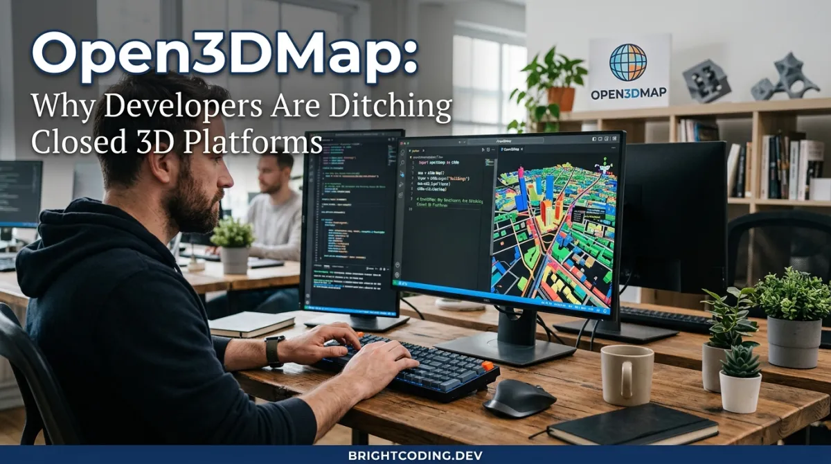
Open3DMap: Why Developers Are Ditching Closed 3D Platforms
What if the next Google Earth wasn't owned by anyone at all?
Here's the brutal truth developers in spatial computing refuse to admit: we've built our most ambitious AR/VR projects on rented land. Every photogrammetry pipeline, every 3D reconstruction tool, every "digital twin" platform comes with invisible chains—proprietary formats, export restrictions, and the ever-present threat of API deprecation. You spend months mastering a workflow, only to discover your data is trapped in someone else's cloud, your scans locked behind enterprise pricing tiers you can't afford.
The pain runs deeper than most acknowledge. Independent creators can't access high-fidelity 3D infrastructure without surrendering ownership. Researchers watch their fieldwork vanish when startups pivot. Civic planners desperate for accurate urban models face a choice: pay astronomical licensing fees or work with outdated, incomplete data.
But what if the solution was already in your pocket?
Enter Open3DMap—a radical reimagining of how we build, share, and maintain three-dimensional representations of our world. This isn't another SaaS platform with a generous free tier and predatory pricing. It's a fully open-source, GPS-anchored 3D mapping ecosystem that transforms any smartphone into a professional-grade spatial capture device, then crowdsources those scans into a living, interoperable global map using the bleeding-edge 3D Gaussian Splatting technique.
The implications are staggering. For the first time, developers can capture photorealistic 3D environments, process them in the browser via WebGPU, and export to universal formats—without writing a single check to a proprietary vendor. The spatial computing revolution just found its public infrastructure. And you're about to learn exactly how to wield it.
What Is Open3DMap?
Open3DMap is an open-source platform for GPS-anchored 3D mapping using crowdsourced mobile scans, built around the revolutionary 3D Gaussian Splatting rendering technique. Created by developer x4dqn and released under CC BY-NC 4.0, it represents a fundamental shift from centralized, corporate-controlled spatial data toward community-owned digital infrastructure.
The project's architecture rests on three interconnected pillars: a mobile capture application (Android, with iOS planned), a cloud processing pipeline powered by Firebase and COLMAP, and a web-based training and management portal that runs Gaussian Splat training directly in the browser via WebAssembly and WebGPU.
Why Gaussian Splats matter: Unlike traditional polygonal meshes or point clouds, Gaussian Splats represent 3D scenes as millions of optimized 3D Gaussian distributions. The result? Photorealistic rendering at real-time frame rates, with soft edges that naturally handle transparency, foliage, and complex geometries that break conventional reconstruction methods. INRIA's groundbreaking 2023 research made this possible; Open3DMap makes it accessible.
The platform's GPS anchoring solves a critical problem that has plagued 3D scanning for decades: geospatial context. Every scan captured through Open3DMap carries precise location metadata in the open SplatJSON format, enabling scans to be composited, compared, and navigated at global scale. A building scan from 2024 can be precisely aligned with its 2025 update. Multiple contributors can extend the same scene without coordinate system nightmares.
Why it's trending now: The convergence of three technologies—mature mobile AR tracking (ARCore), browser-based GPU compute (WebGPU), and production-ready Gaussian Splatting implementations (Brush)—has created an inflection point. Open3DMap is the first project to weave these together into a cohesive, end-to-end open workflow. Developers recognize this alignment and are migrating rapidly from fragmented proprietary toolchains.
Key Features That Separate Open3DMap from the Pack
End-to-End Open Architecture
Every component—from capture to training to export—uses open standards or open source. The SplatJSON metadata specification is publicly documented. The Brush training engine is MIT-licensed. Your data never hits a black-box API you can't inspect or replicate.
Browser-Based Gaussian Splat Training
This is where jaws drop. Open3DMap compiles the Brush training engine to WebAssembly and executes it via WebGPU, enabling full Gaussian Splat training without installing software. The dashboard streams real-time progress, loss curves, and preview renders. For developers building web-first spatial applications, this eliminates the traditional "export to desktop tool, wait, re-import" friction entirely.
Firebase-Powered Cloud COLMAP Pipeline
The backend runs COLMAP (the gold-standard Structure-from-Motion library) in Firebase Functions with beefy 16GiB RAM/4 CPU configurations and 60-minute timeouts. Parallel image downloads with intelligent retry logic handle spotty mobile uploads. Structured logging with timestamps lets you debug failures without SSH access. A dedicated health check endpoint verifies COLMAP, cmake, python3, and gcc availability before accepting jobs.
Real-Time Progress Streaming
Both the COLMAP conversion and Brush training phases push live updates to the web dashboard. Contributors watch their scans progress from raw images to trained splats without refreshing—critical for maintaining engagement in crowdsourced workflows.
Multi-Format Export Ecosystem
Trained outputs export as PLY (industry standard for Gaussian Splats), with planned support for .splat, .splatjson, .glb, .usdz, and .obj. This interoperability matrix means your Open3DMap captures feed directly into Unity, WebXR, Cesium, Blender, and Unreal Engine pipelines.
Privacy-First, Ethics-By-Design
The roadmap explicitly includes PII blurring, contributor-defined licensing (CC-BY, CC0), opt-in visibility controls, and ethical scanning defaults. This isn't an afterthought—it's structural preparation for responsible scaling.
Use Cases: Where Open3DMap Transforms Real-World Problems
1. Civic Planning & Urban Informatics
Municipalities need accurate 3D models for zoning, disaster preparedness, and infrastructure planning. Commercial LiDAR surveys cost $50,000-$200,000 per square kilometer. With Open3DMap, city employees and volunteers capture street-level detail using existing phones, process through the cloud pipeline, and merge scans into block-scale models. The temporal maintenance roadmap enables change detection for construction monitoring and decay tracking.
2. Cultural Heritage Preservation
Archaeological sites, endangered architecture, and museum collections demand documentation before irretrievable loss. Open3DMap's offline-first capture with later cloud sync works in remote locations without reliable connectivity. The SplatJSON format ensures future researchers can locate, understand, and extend recordings decades later. Federated hosting planned for museums and collectives prevents single-point-of-failure archiving.
3. Independent Game Development & Virtual Production
Indie studios and virtual production teams need environmental authenticity without location scouting budgets. Contributors capture real-world references—Tokyo alleyways, Patagonian landscapes, European cathedrals—and share under Creative Commons licenses. The Unity and WebXR SDKs in development will enable direct scene import, while the Gaussian Splat format provides superior visual fidelity to photogrammetry meshes for background plates.
4. Academic Research & Citizen Science
Ecologists track forest canopy changes. Geologists document erosion patterns. Sociologists study public space utilization. Open3DMap's versioning and time-indexing support systematic comparison across capture sessions. The public API and OGC-aligned GeoPose support integrate with existing GIS workflows, while the reputation system incentivizes quality contributions from distributed volunteer networks.
5. AR Experience Deployment
WebXR developers building location-based AR experiences face the "empty world" problem—compelling content requires spatial understanding of the physical environment. Open3DMap's GPS-anchored scans provide this foundation at scale, with composability enabling gradual scene refinement as more contributors map the same location.
Step-by-Step Installation & Setup Guide
Web Portal (Local Development)
The web platform requires modern tooling but rewards you with full local control:
Prerequisites:
- Node.js 18+ (20+ strongly recommended for WebGPU stability)
- Chrome 113+ with WebGPU and hardware acceleration enabled (
chrome://flags/#enable-webgpu) - Rust +
wasm-pack(only if rebuilding Brush WASM; prebuilt artifacts included)
Installation Commands:
# Clone the repository
git clone https://github.com/x4dqn/Open3DMap.git
cd Open3DMap

# Navigate to web directory and install dependencies
cd open3dmap-web
npm install

# Optional: Rebuild Brush WASM from source (requires Rust toolchain)
node build-brush-wasm.js

# Start development server with auto-configuration
node start-dev.js
The start-dev.js script automatically generates js/firebase-config.js via build-config.js if missing—no manual Firebase setup required for initial exploration.
Access Points:
- Main Application:
http://localhost:3000/ - Scan Dashboard:
http://localhost:3000/dashboard.html - Brush Trainer Interface:
http://localhost:3000/brush-trainer.html
Critical Configuration Note: Verify WebGPU activation in Chrome by visiting chrome://gpu and confirming "WebGPU: Hardware accelerated" status. Training will fail silently or fall back to non-functional CPU emulation without this.
Mobile Capture App (Android)
Prerequisites:
- Android device with ARCore support (check Google's official list)
- Android 8.0 (API level 26) or higher
- Google Play Services installed and updated
- Camera, location, and storage permissions enabled
Option 1: Direct APK Installation (Fastest)
- Download
Open3DMap - Scanner.apkfrom the repository releases - Enable Settings → Security → Install unknown apps for your browser/file manager
- Install and launch; grant all permission prompts
- Verify ARCore initialization via the camera preview
Option 2: Build from Source (For Customization)
# Clone repository
git clone https://github.com/x4dqn/Open3DMap.git
cd Open3DMap

# Open in Android Studio and navigate to:
# AndroidApp/Scanner → Open → Sync Gradle → Run on device
Connect your ARCore-capable device, select it from the device dropdown, and click the green Run button. The build process typically completes in 3-5 minutes on modern hardware.
REAL Code Examples from the Repository
Example 1: Web Portal Development Server Bootstrap
The repository's development workflow is orchestrated through a Node.js script that handles Firebase configuration generation and server startup:
# From repo root
cd open3dmap-web
npm install

# Build Brush WASM (optional if using prebuilt)
node build-brush-wasm.js

# Start local server
node start-dev.js
What's happening here: The npm install pulls dependencies for the web dashboard, training interface, and Firebase integration. The optional build-brush-wasm.js invokes wasm-pack to compile Rust source to WebAssembly—though prebuilt artifacts (brush_wasm.js, brush_wasm_bg.wasm) are included for immediate use. The start-dev.js script is the critical automation: it detects missing Firebase configuration and generates it programmatically, eliminating a common setup failure point. This design choice reveals the project's contributor-friendly philosophy—reduce friction at every entry point.
Example 2: Mobile Scan Export Structure
After capturing a scan, the Android app produces a standardized directory hierarchy:
Open3DMaps/Exports/
└── ScanName_2024-01-15_14-30/          # Timestamped, human-readable
    ├── images/                          # Raw capture frames for COLMAP
    │   ├── frame_000.jpg
    │   ├── frame_001.jpg
    │   └── ...                          # Typically 50-500 frames per scan
    └── metadata/                        # Spatial and session context
        ├── transforms.json              # ARCore camera poses (rotation/translation matrices)
        ├── session_[ID].json            # IMU telemetry, quality metrics, device info
        └── scan_id.splatjson            # Open3DMap's georeferenced metadata standard
Deep technical breakdown: The transforms.json follows the Nerfstudio/NeRF conventions—4x4 transformation matrices mapping each frame's camera coordinate system to a shared world origin. This direct compatibility means Open3DMap exports feed into instant-ngp, Nerfstudio, and other neural rendering pipelines without conversion. The session_[ID].json captures accelerometer and gyroscope readings, enabling future research into IMU-enhanced reconstruction or motion blur compensation. Most critically, scan_id.splatjson implements the project's open standard: GPS coordinates (WGS84), capture timestamp, contributor attribution, licensing tags, and composability metadata that specifies how this scan relates to neighboring captures. This is the interoperability layer that prevents vendor lock-in.
Example 3: Cloud COLMAP Pipeline Architecture
The Firebase Functions backend implements a robust, observable reconstruction pipeline:
Callable function: processCOLMAP

Execution flow:
  1. download          → Parallel image fetch with exponential backoff retry
  2. feature extraction → SIFT/SuperPoint feature detection per image
  3. matching          → Exhaustive or sequential matching with geometric verification
  4. sparse reconstruction → Bundle adjustment for camera poses and sparse point cloud
  5. upload            → Structured results to cloud storage with metadata linking

Resource envelope: 16GiB RAM, 4 vCPU, 60-minute timeout
Observability: Real-time streaming logs with stage timestamps
Validation: Health check endpoint verifies COLMAP, cmake, python3, gcc availability
Why this architecture matters: The 16GiB/4 CPU configuration is deliberately oversized for typical COLMAP workloads, accommodating challenging datasets with thousands of images or poor initial geometry. The 60-minute timeout exceeds Firebase's default 540-second limit, requiring explicit configuration—evidence the developers have operated this at scale and hit real constraints. Parallel downloads with retries address the reality of mobile-uploaded imagery: intermittent connectivity, large file counts, and occasional storage failures. The structured logging isn't decorative—it's essential for debugging when reconstruction fails at 2 AM on a contributor's dataset you've never seen. The health check endpoint (processCOLMAP/health or similar) enables proactive monitoring before job submission, preventing wasted compute on broken deployments.
Example 4: Browser Training Workflow (Brush WASM Integration)
The dashboard integrates training through a modal interface that bridges cloud storage and browser compute:
Workflow in dashboard.html:

1. Select scan from contributor's scan cards
2. Click magic wand (🪄) → training modal opens
3. Conditional branch:
   IF COLMAP results missing:
     → Trigger "Convert with COLMAP" (cloud pipeline)
     → Await completion notification via Firebase Realtime/ Firestore
   ELSE:
     → Proceed to training
4. Click "Train with Brush" → WebAssembly module initializes
5. WebGPU context acquired → training kernels compile
6. Live progress: loss curves, iteration count, preview render
7. Completion → automatic PLY export + cloud storage upload
The technical achievement here cannot be overstated. Brush—the underlying training engine—was designed as a native Rust application. Open3DMap's team cross-compiled it to WebAssembly, then implemented WebGPU compute shaders to replace CUDA/Metal kernels. This means GPU-accelerated Gaussian Splat training executing in a sandboxed browser environment, with no installation, no driver conflicts, and no platform-specific builds. The modal UX pattern (convert → train → export) abstracts this complexity into a three-click workflow that non-technical contributors can navigate. The automatic cloud upload ensures trained assets are immediately available for the map viewer and export pipeline.
Advanced Usage & Best Practices
Capture Quality Optimization
Move at walking pace with the camera pointed at textured, non-specular surfaces. Overlap between frames should exceed 60%—the ARCore tracking degrades with rapid rotation or featureless walls (white corridors, dark rooms). Outdoor scans benefit from overcast conditions that eliminate harsh shadows that confuse photometric consistency checks.
COLMAP Parameter Tuning
The "enhanced parameters" mentioned in the documentation specifically address image registration failures. For challenging datasets, consider adjusting the min_num_matches threshold or enabling sequential matching for video-like captures. The streaming logs reveal which stage fails—use this to guide parameter experimentation.
WebGPU Performance
Training speed scales dramatically with GPU memory bandwidth. Dedicated GPUs (NVIDIA RTX, AMD RDNA3) achieve 10-50x speedup over integrated graphics. For production deployments, consider requiring WebGPU adapter info checks and directing users to hardware-accelerated environments.
SplatJSON Composability
When extending existing scenes, ensure GPS accuracy within 5 meters and capture overlapping visual features. The incremental scan integration (in development) will use both geometric and semantic consistency checks—prepare now by maintaining high-quality metadata.
Offline-First Strategy
The mobile app's offline capture with later sync is ideal for remote locations. Export immediately after capture to local storage as backup, then trigger upload when connectivity returns. The session_[ID].json preserves temporal ordering for correct COLMAP sequential matching.
Comparison with Alternatives
| Feature | Open3DMap | Polycam | Luma AI | Scaniverse | RealityScan |
|---|---|---|---|---|---|
| License | CC BY-NC 4.0 (open source) | Proprietary | Proprietary | Proprietary | Proprietary |
| GPS Anchoring | ✅ Native SplatJSON | ❌ Manual only | ❌ Manual only | ❌ None | ❌ None |
| Gaussian Splats | ✅ Native pipeline | ❌ Mesh/point cloud | ✅ Export only | ❌ Mesh only | ❌ Mesh only |
| Browser Training | ✅ WebGPU/WASM | ❌ Cloud only | ❌ Cloud only | ❌ App only | ❌ Desktop only |
| Open Format Export | ✅ .splatjson, .ply, planned .glb/.usdz | Limited | Limited | Limited | Limited |
| Crowdsourced Compositing | ✅ Roadmap active | ❌ Individual only | ❌ Individual only | ❌ Individual only | ❌ Individual only |
| Self-Hostable | ✅ Full stack↗ Bright Coding Blog open | ❌ SaaS only | ❌ SaaS only | ❌ SaaS only | ❌ SaaS only |
| Cost | Free (self-hosted) | Freemium/$300+/mo | Credits-based | Free (limited) | Free (limited) |
The verdict: Commercial tools optimize for individual convenience with hidden long-term costs. Open3DMap trades some polish for sovereignty—your data, your infrastructure, your formats. For developers building products on spatial data, this isn't ideological preference; it's architectural risk management.
FAQ
Q: Can I use Open3DMap for commercial projects? The codebase is CC BY-NC 4.0 (non-commercial). Commercial licensing discussions should be directed to the repository maintainers. The SplatJSON specification itself is designed for unrestricted implementation.
Q: What Android devices work for capture? Any ARCore-supported device running Android 8.0+. Flagship devices (Pixel, Samsung Galaxy S/Note series) provide superior tracking stability and capture frame rates.
Q: How long does browser training take? Typical scenes (100-300 images) train in 15-45 minutes on dedicated GPUs, 2-4 hours on integrated graphics. The real-time progress indicator provides accurate time estimates after the first 100 iterations.
Q: Can I contribute scans without technical expertise? Absolutely. The mobile app requires only permission grants and a "Start/Stop Scan" interaction. The web dashboard handles all processing automatically. Technical knowledge only needed for local development or custom pipeline modifications.
Q: How does GPS accuracy affect scan compositing? Current consumer GPS provides ~3-5 meter accuracy. The SplatJSON format records precision estimates, and the composability roadmap includes visual feature alignment to refine coarse GPS positioning. For now, capture overlapping regions to enable manual alignment.
Q: Is iOS support coming? Listed as planned on the roadmap. ARKit integration is structurally similar to ARCore; community contributions could accelerate this timeline significantly.
Q: How do I verify my WebGPU setup?
Visit chrome://gpu, search for "WebGPU," and confirm "Hardware accelerated." If unavailable, update Chrome, enable the #enable-webgpu flag, and ensure your GPU drivers are current.
Conclusion
Open3DMap arrives at a pivotal moment. The spatial computing industry has spent a decade building impressive proprietary demos while neglecting the foundational infrastructure that would let thousands of creators participate. By open-sourcing the entire pipeline—from mobile capture through browser-based Gaussian Splat training to georeferenced metadata standards—this project offers something genuinely rare: a credible path to democratic 3D mapping.
The technical execution impresses. WebGPU training in the browser isn't a gimmick; it's a genuine elimination of a workflow bottleneck that has slowed Gaussian Splat adoption. The Firebase COLMAP pipeline demonstrates production-hardened engineering, not prototype code. And the SplatJSON format, with its explicit attention to composability and licensing, shows architectural thinking about ecosystem growth rather than single-user convenience.
Is it polished? Not yet. The iOS gap, the in-development features, the occasional rough edge in documentation—these are real. But for developers who have watched proprietary platforms extract rent from spatial data while offering zero interoperability, Open3DMap represents strategic optionality. You can host it yourself. You can modify it. You can extend it. And critically, you can leave without losing your data.
The crowdsourced 3D mapping revolution won't be televised—it'll be scanned, trained, and shared by developers who recognized early that public infrastructure beats private platforms. Get the code, capture your first scan, and start building the open spatial web today:
👉 Star and clone Open3DMap on GitHub
The map is empty. That's the opportunity.
Outils recommandés
Explore on the BrightCoding network
Hand-picked resources from our other sites.
WhisperCrabs: The Secret Weapon Top Linux Devs Use for Voice Coding
Discover WhisperCrabs, the floating voice-to-text tool that transcribes speech directly to your clipboard. Local-first with whisper.cpp, AI-agent ready via D-Bu...
yvgude/lean-ctx: Cut AI Agent Token Costs 60-90% with Local Context Engineering
LeanCTX is a local Rust binary that reduces AI agent token costs 60-90% through context engineering: intelligent compression, cached reads, persistent memory, a...
Stop Cleaning Excel Manually! This AI Agent Does It in Docker
Discover how EmergenceAI's Data Preparation Agent transforms messy Excel files into clean CSV using AI and Docker. No coding required—just describe what you nee...
Continuez votre lecture
Why Alexandrie is the Ultimate Markdown Note-Taking App

Why CrossPaste is the Ultimate Game Changer for Clipboard Management
Why Chandra is the Ultimate OCR Tool for Handwriting and Tables
Stop Coding Alone: OPC-Skills Gives Your AI Agent Superpowers
Commentaires 0
Aucun commentaire pour l'instant. Soyez le premier à réagir !